The sights of the Fan Mountains
Iskanderkul
<…Having made our way between the bushes and near the gigantic blocks of stones blackened in times, I instinctively went a few paces down towards that slope which blocked the river and then stopped our packs. The sounds were similar to the wheels of a mill and undoubtedly it was clear that the waterfall is hidden somewhere. But it was hard to come close to the river. Finely, having found a proper place and bent over I was fascinated to see an interesting scene, a great waterfall was in front of me. There were several plants covered by the white dust of the water. This dust was painted a little with pinkish color…>.
V.I. Lipski “Gornaya Bukhara”
The Niagara Fan which is at the same famous water reservoir in Tajikistan is located 300 meters from the mysterious Snake Lake – Mountain which can create an intrigue and let the wishes comes true.
In ancient times Alexander the Great during his campaign towards India had stopped here whose name was inscribed on the “pearl of the mountain” - Alexander Lake and there is a legend that the legendary horse of Alexander – Bucephalus had drowned here and the only selected one had seen it. They passed this mystical story from mouth to mouth.
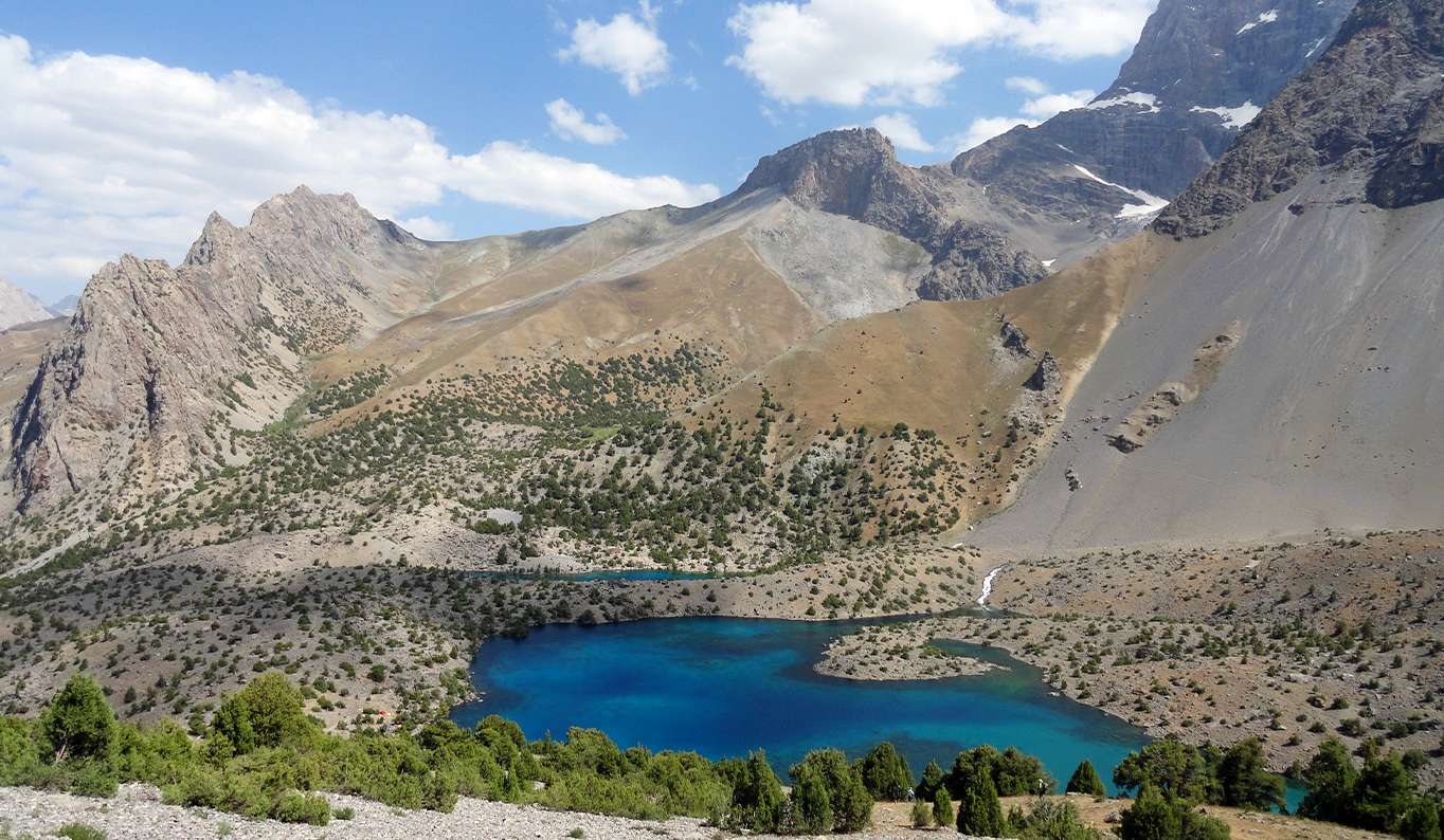
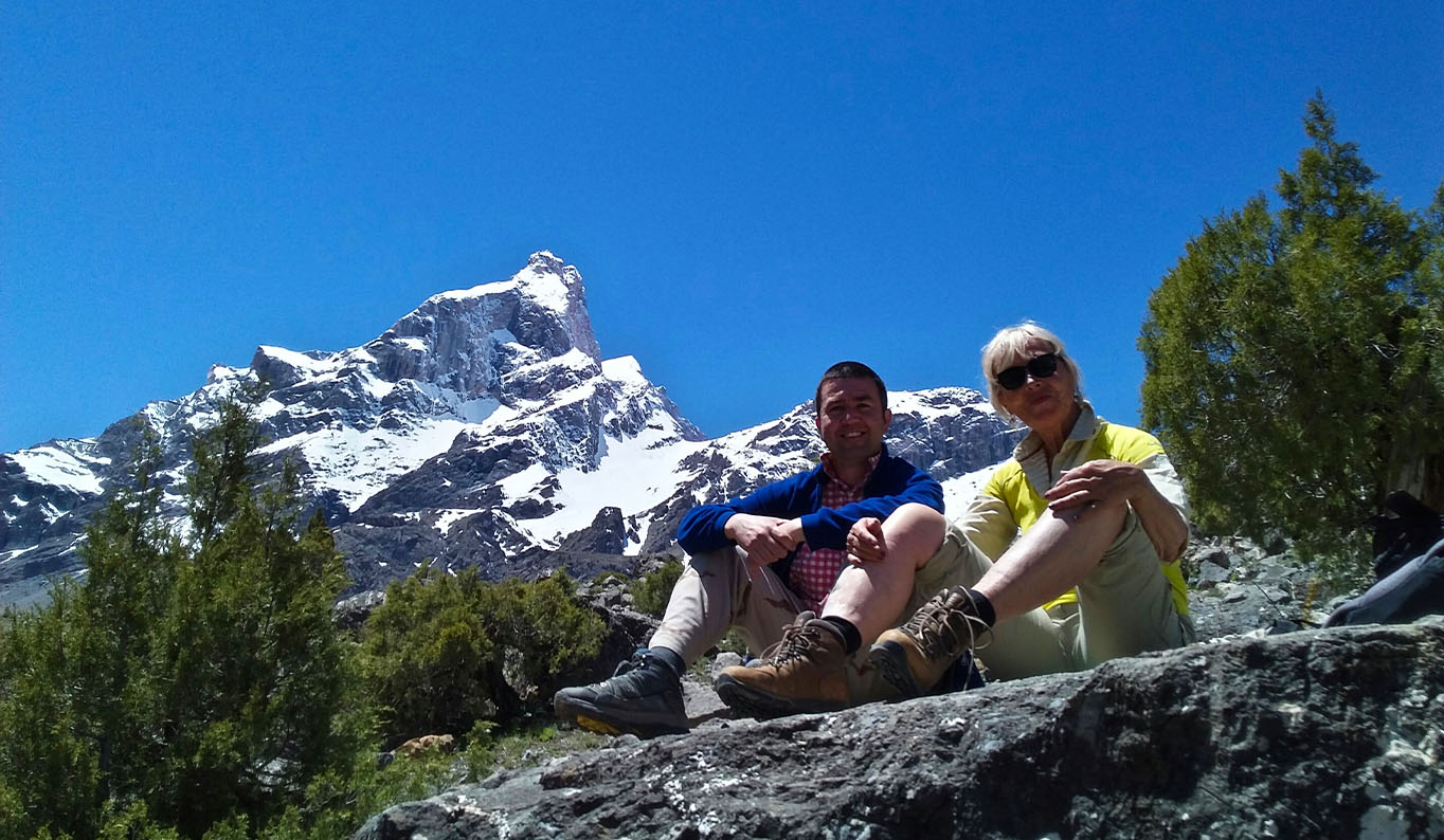
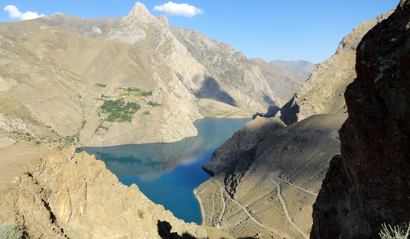
The lake is located on 2195 meters above sea level between the western end of Gissar and Zerafshan ridges, Soghd Province of Tajikistan, half way from Khujand to Dushanbe or from Dushanbe to Samarkand. Iskanderkul knows how to charm and attract people. This is not the only fascinating scenery of the lake, not at all, the smooth water surface which has the rectangle shape with an area of 3,5 square km and 70 m depth, the cold water that only hard-tempered and reckless people can swim in it in summers, but the romantics under the clear and starry night of myriad, clinging silence, songs under the guitar at the fire place, ascent to the top of the surrounding peaks and rushing towards the blue sky. The untouchable waterfall which was described in 1905 by the investigator Lipskiy in his works and hello from XIX century inscribed on a rock “Here were… ” by the traveller and explorer Alexey Fedchenko “Russians 1870” is a great admiration.
The Iskanderkul Lake appeared due to a landslide. It was formed due to a mountain collapse after an earthquake (like Sarez Lake) when the rocks collapsed and blocked the Hazormech and Saritag valley creating a natural reservoir surrounded by mountain ridges from 11 of it is 5 km high. It is possible to meet a variety of flora and fauna, starting from forest, steppes, pastures and mountains (apricots, mosses, lichens) and finishing with hairs, wolves, brown and red marmots, brown bears, mountain goats, rocky partridges, griffon-vulture and quails.
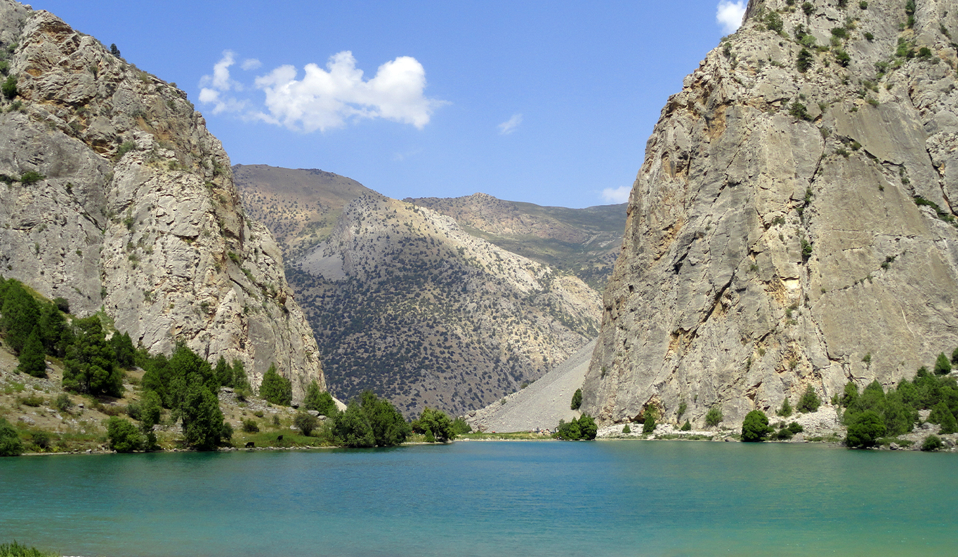
There is a Snake Lake approximately 300 m from the waterfall. The water is warmer in it than in Iskandaerkul and there were no snakes but the locals told on the contrary. From the “Alexander Lake” streams “Alexander River” –Iskanderdarya flowing into the Fan River which is the inflow of the largest river in Central Asia Zerafshan (translated as “gold spilling”). So the “Niagara Fall” is exactly located at 800 m downstream here and this is one the fabulous sights which tourists should visit. From the watching platform one can see the fascinating scenery – the drops of water spraying in the sun the water dust creates a splendid rainbow.
The heart of the Fan Mountains – Iskanderkul is protected by rocks of Chapdara, Bodkhona (the house of winds), Mirali, Mariya, Zindan (a jail) like gigantic giants. The highest of them is Chimtarga 5489 meters above sea level. One of the peaks is called Dojdemernaya (3342 meters above sea level and is translated “Kuhi chuli boi”), the dome of which is standing right over the lake that helps the locals to predict the weather forecast. If it is covered by clouds it will rain.
When the reflection of Dojdemerni touches the smooth surface of the lake with the reflection of the furious Kirkshaitan (the mountain of the forty Satan) something unpredictable and hardly perceptible and elusive happens, may be the cry of the rocky giants or the heartbeat of their cold hearts narrates about the long time of the harsh past.
The Kulikalon lakes
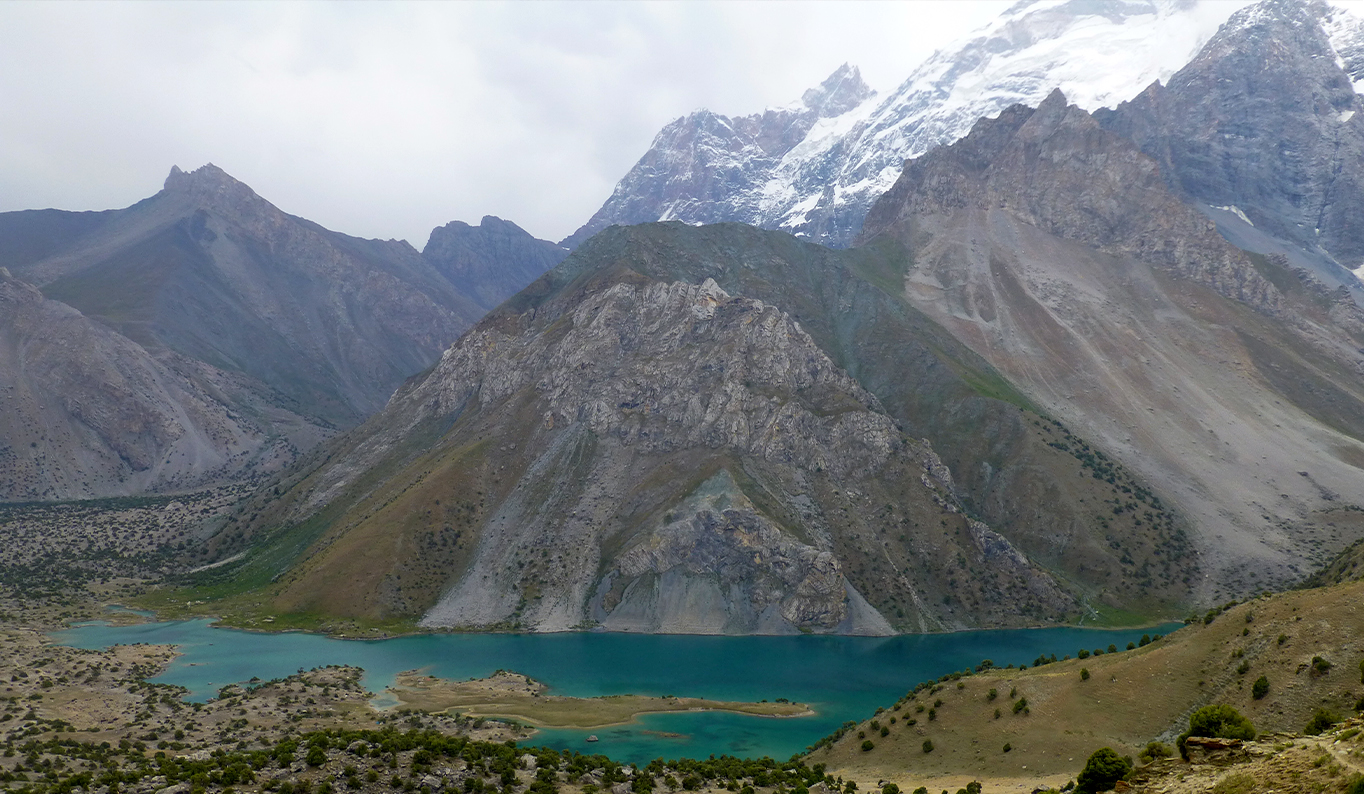
Kulikalon lakes is 2800 meters above sea level and the only transport is donkey. The Kulikalon lakes are so beautiful and so hard to access for any kind of transport besides legs of course. About ten glacier reservoirs are hidden at the western part of the Kulikalon basin. The biggest of them is Kulikalon, translated as “a big lake”. It has fish which were thrown from the newly hatched fish long time ago. A small inflow divides the lake into two parts the small and big lakes. The lake has two inflows – one is from the south and the second is from the eastern part.
The water from the small lake goes downwards and appears in 600 meters and gives life to the Urech river but the big lake changes its temperature and color. For instance the temperature of the southern part reaches +15˚С and it is possible to swim in it and the colors change from light-green to emerald and turquoise. There is a haunted fluorite mine above the Kulikalon Lake where one can find beautiful semi-precious stones.
The interesting fact is that the Kulikalon basin consists of the moraine lakes, the most upper of them is Dushakha (3000 m above sea level) located at the south and eastern part close to the hole of Chimtarga (translated “a wall, a fence”), under the walls of Mirali and has a delta shape. The name of the Kulikalon is taken from the gathering lakes of the basin.
The Kulikalon basin is visible even from the meadow peak of Fluorite (3445 m) and from both sides the lakes glister and in front it the peak of Ruziravat (3640 m) is also possible to see. The alpinist peaks of Aurondag (4570 m), Rudaki (4400 m), Mariya (4790 m) and the above mentioned Mirali (5106 m) ascend in the opposite direction. The routes to the Laudan pass (3630 m) and Allaudin pass (3860 m) are in the eastern part and to the Allaudin Lake. The western part of it gives an opportunity to ascend to the acclimatization pass Chukurak (3150 m) and to admire the beauty of the scenery and the Kulikalon lakes.
The fact is that the atmosphere of the Kulikallon lakes is special. It has uniquely warm and silent atmosphere. In other parts if one can hear stone slide but at the lakes it is always calm and comfortable like at home.
Alaudin Lakes
The cascade from seven lakes which are located higher than the previous streaming with the emerald-blue water as if from one cup to the other. Crystal-clear and fascinating lakes of the Alaudin is another incontestable natural wonder of the Fan Mountains and the water basin of Pasruddarya, the left inflow of Fandara which takes its source from the snowcapped eastern slopes of the Laudan pass above three kilometer elevation.
According to the scientists` points of view the lake was formed 10000 years ago due to the melting of the old glaciers covering the most part of the Fan Mountains. One of the glaciers had a period balance of melting process and sequentially the finite moraines seceded above the Big Lake Alaudin in the result and upper of it like three moraine banks filled up in intervals with the ground deposits and with multiple preserved moraine lakes. The remnant of that glacier is possible to see at the Mutni Lake.
The water of Alaudin as if argues with the sky proving that whose color is bluer, clearer and more beautiful. Of course it wins in this private argument – like a highlight within the neon light charms and offers to touch with hand and to use that beautiful color which one can see in touch. And then soundlessly asks: Did you make sure that my water is pure like a child’s tear and nothing can make it gloomy, not the noisy flow under the trails of Chapdara. The clue is simple – the clarity of the water lake is kept by the stone filter with five km depth.
There is no fish in Allaudin but the water has a good temperature for those who are fond of cold bath. There is a juniper forest on both sides of it and the two kilometer red Chapdara walls are above it. In the east from the Big lake there is the Eastern Lake which has an underground inflow.
In spite of its high location above sea level (2700 m) the climate of the Allaudin area is mild and comfortable due to its mountain massifs of the surrounding peaks of Chapdara, Adamtash (“a stone man” in English) and Zamok peak.
If you ascend upwards from the lake towards the corridor of the ravine after two hours you will reach to the beautiful lake Mutni (3490 m) which is located among the mountain massifs, western part is Zamok and eastern part Chimtarga. As if flying one by one on the way. On the you also can admire the beauty of a small and almost round crystal and transparent water of Piyla (Tajik Piyola Lake – “a cup”), reminds a dug cup continuously filling up from a stream roughly coming out of the pebbles. The water in Piyala is crystal like glass but very cold for swimming.
In order to reach the lakes from Dushanbe it is possible by Istaklal Tunnel then Aini settlement and Pasrud.
Balshoye Allo and Maloye Allo
Balshoye Allo and Maloye Allo are lost in the mountains at 3150 meters above sea level with the purest water and blue smoothness surrounded by rocks at three sides in the Zindon gorge. Balshoye Allo Lake in the Fan Mountains attracts people with its color and crystal water and with the juniper trees at its banks. It is possible to reach it by crossing the Chimtarga pass (4750 m) and one should spend much energy for this steep ascent and for sure it would be worth – the peaks of Maloy and Balshoy Ganza, the top of the Krasni Zor, the giant Zamok and Payambar appear in front of you without any doubt. And then after ascending downward to the Zindon river gorge by trails, Balshoye Ekho (the name of the lake in translation) will open in front of a tired pilgrim.
In the silence of the pass where there is no barrier for the wind,
In the steep slopes like this where nobody has ever been,
Lived happily the mountainous echo,
It recalled the call of a man.
V.S. Visotski
And indeed the Balshoye Allo as if the embodiment of the known and beloved bard’s poem has been lost in the mountains hiding its beauty. Of course one can see the colors of the water smoothness constantly changing depending on the times of the year from the sky blue to the swamp green tint however remaining maximally crystal at the fantastic sunset, myriads of starry night and the giant peaks. It is possible to have a rest from the hustles and to sink the body into the water and to wish something sincerely and of course according to the beliefs if the wish is sincere it will happen for sure. And then to ascend downwards using the same trails towards Maloye Allo the brother of Balshoye Echo, where the air is mild and warmer and covered by the aromatic mint of the currants and the lavenders. After then visit the closest settlements where the dwellers happily will invite you for a bread and delicious sour cream.
The Marguzor Lakes
Mijgon (“Eyelashes”), Soya (“Shade”), Hushyor (“Watchful”), Nofin (“Bellybutton”), Khurdak (“Small”), Marghuzor (“Pasture”) and Hazorchashma (“Thousand springs”) are the seven inseparable sisters of Marguzor lakes which are located at the foot of the Fan Mountains, at the spur of the Zerafshan Ridges, and the whole stream of Shing river from 1600 to 2400 meters above sea level. It is possible to reach from the ancient Tajik city Penjikent and the five thousand peaks of the Kuhistans are visible already from there, from Taror settlement, and then 30 km upwards along a winding road.
The uncomfortable piece of road will compensate a beautiful picturesque and incredible mountain air with interest. The seven lakes as if are waiting for travellers in order to charm and to capture hearts forever.
The colorful tints of Mijgon (1640 m above sea level) plays and meets the guests with its morning blue color which changes into green after a few hours and then as if pouring from the air changes into blue-green so as to remain orange for the evening. They say such wonderful coloring of the lake has its legend and according to the legend the beautiful daughter of a blacksmith Mijgon in order to avoid marriage with a respectable and very old padshakh jumped from a roof of a high palace. A lake was formed at the place of her death. But her six sisters could not bear the death of her sister and begged God with tear to turn them into lakes just to share the fate of their elder sister eternally. But there is another legend the demons are connected with that, the eastern spirits and giants from whom the beautiful girls were attempting to hide. And they found but the girls begged the God to hide them. So in the place of girls appeared a water reservoir and in the place of demons appeared mountains. The peaks preserve inseparable love and the water gifts beauty for the surroundings.
A little upper there is another lake Soya under the shade of a chinar attracts passersby to have a rest under its shade. The two rocks which it is located between them give a natural shade and this is the most probable name. And here it is the third lake Hushyor calls up people to be watchful. According to the legends before it had many venomous snakes and the locals warned people to be careful. Though, according to another version one should be watchful at the fourth water reservoir because of the narrow and winding trails which lead towards it.
In the middle of the Marguzor cascade there is the fourth lake Nofin (2 km length and 400 m width) as if the bellybutton connecting all sister together. According to the legends which the locals assure narrating about the seven beautiful girls of Shing, once upon a time here was a massacre of innocent people. That’s why the color of the lake turns into red. And the locals assure that one should to sacrifice a sheep or a hen in order to calm down the water and to bring its previous blue color.
Simultaneously after the water reservoir there is a settlement of Padrud, the people of which are happy and laborious. They create small gardens on a piece of land beneath of the mountain river with their hands and do cattle-breeding. After the settlement the smallest lake is located Khurdak. Its length is 240 m with the milky white color behind which there is a pasture. That’s why the translation of the sixth lake is Marguzor. This is the largest lake of the cascade with 4,5 km length and 45 m depth. It is 2200 meter above sea level. The tints of the lake reminds us the game of the light torches from bluish to the blue-violet color. It is possible to see the pictures of the primitive people on a lump of the lime stone not far from the lake and the remnant of the ancient prototype mountain dressing works. The northern slope of the lake dam is surrounded by thick bushes with high trees and fragrant grasses and streams.
Our journey finishes with the fascinating and incredible lake cascade at 2400 meters above sea level Hazorchashma Lake. It is harsh and cold but again charming and attractive. There are deep caves and the deposit of Island spar is located in one of them and also varieties of minerals are met here: malachite, mountain crystal, antimonite and others.
All seven lakes besides Hazorchashma are formed due to the landslide and the difference of the altitudes between the upper and lower lake is 692 meters.
“Yagnob gorge” – Yagnob
The Yagnob gorge is located between two mountains behind the Anzob mountain pass (3372) with 60 km extension and approximately 105 km to the northern part of Dushanbe. In the early XX century an expedition group of investigators went to the same gorge to investigate the history of a nation which lived at the elevation of 2000 to 3000 meters and spoke with the unknown language like Hindi the Tajiks named. However after a long research it was found out that the language which they speak was one of the old dialects of the Soghdian language. So, another new reserved island was added to the living Badakhshani (Pamiri) languages of the Eastern-Iranian world.
The Yagnob river is formed by Kumbil and Barzenga rivers which take their source from the mountain glacier of Takali and at the same time flows into Zerafshan dividing the Zerafshan ridges from the Gissar. The upper part of it is famous with its alpine and subalpine meadows. There is not a permanent dwellers. Only the shepherds wonder in summers with their herds.
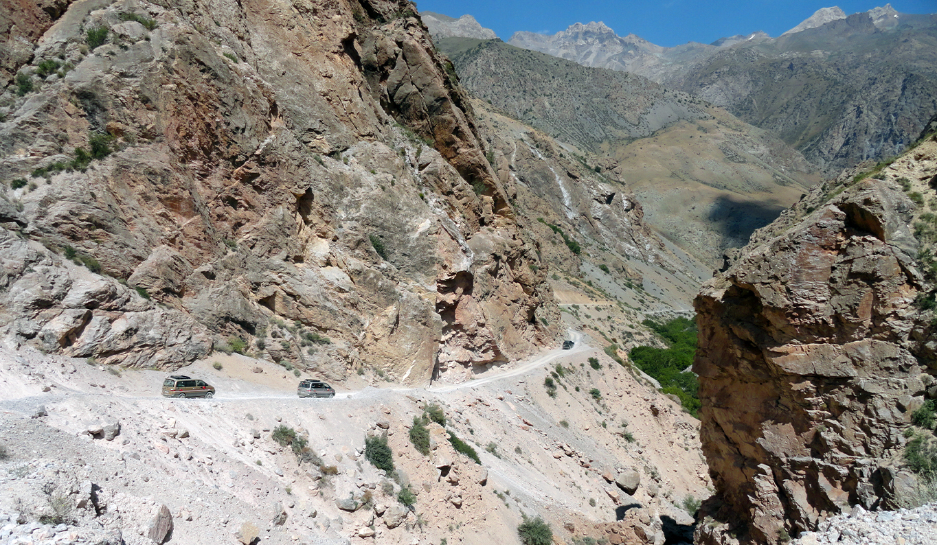
It is impossible to reach the gorge because the car road leads until the Yagnob-Margib settlement, above which the rocky massif dominates the territory which is named “the Yagnob Walls” or by locals “Zaminkaror” – “holding the earth”, closing the winding gorge. After crossing the Lataband pass you will reach the world of picturesque with peculiar landscape. As if the mountains are divided into three parts: steep rocks are in the upper part, in the middle part 40-50° angularly covered by grass and woodless slopes where all the settlements are located and dry cliffs are in the lower part descending downward to Yagnob. There is no any plain surface “where one could lie down without feeling the bend of the soil” – wrote the famous ethnographer M.S. Andreev who worked in Yagnob in 1920s.
In 1970s, XX century the population of Yagnob was totally moved to the Fergana valley, Zafarabad district where people were engaged in cotton-growing depriving them not only from their initial place of living but also caused a great damage on their tradition and culture. Later (1989, 1990) mutual expedition of the Institute of History, Cultural Fund of Tajikistan and Harvard University of the USA discovered and investigated 33 settlements of the Yagnob valley the majority of which were the abandoned and collapsed houses. However, another interesting fact is that, after several decades the Yagnobians began to return back to their homelands and rebuilding their houses.
The cold climate of the area brought its corrections that’s why the traditional Yangob settlements “men” or “main” have the complex and stable picturesque planning consisting of numerous living buildings often under one roof where the reserve of fuel and food for cattle are kept. The ceiling is propped on the carved beams; the walls have niches where the household is kept in them. The stoves and the fireplaces are the most important belongings of all houses.
Due to the characteristic features of the relief some of the settlements (Tagi-Chinor, Pitip, Sokan, Bidev) have lining or stretching composition, or like the conglomerate construction upcoming both in horizontal as in traverse directions (the settlements of Margtumain, Pullarout, Kirente, Mushtif, Shoveta and others.). Almost each of the settlements had a small fortress connected to the neighboring settlements with good view long time ago. The settlements which were in the opposite side of the river were named abarimen and the small settlements “sputniki” not far from the main, chintirmen.
The interesting fact is that all the Yagnob settlements were located at the slope and were the only architectural school. Small settlements organized conglomerates and the big settlements consisted of stiffly constructed blocks –bulaks. For instance the Khshartob settlement was formed from 5 bulaks reminding each other the accreted crystal.
The Yangob mosques have a particular construction, stretching along the relief halls with aivans at the main facade or built at the side which divides the building into two column paces making the location of Mehrab complicated (the mosques of Pulla Rout, Kiryonte, Petip settlements). Traditionally there were no understanding the construction of such thing and there were clay made arks or niches.
Following the Islamic faith the Yagnob people still preserved the pre-Islamic cults and traditions like worshiping the fire, so the numerous sacred places-mazarz surrounded by mysterious eagles are the best eyewitness of the pre-Islamic cults.
Anzob mountain pass and “Istiklal” tunnel.
In 1936 Dushanbe-Uratube mountain road was built at the Gissar ridges (present Istarafshan) which became one of the highest mountain road in the former USSR after the Pamir Highway. The name of the pass came from the Yagnobi language preserving the first part Anzobi gar – “Anzob Pass” (gar – “mountain”, “pass”).
The word “anzob” under which the scientists mention the Anzob settlement was mentioned in the Soghdian document of the VIII century and in fact the settlement of Anzob was mentioned there. The truth is that the settlement was located in another place but in order to prevent the spread of plague the settlement was moved to the right side of Yagnob River in 1898 by the pilgrims close to the tomb of Ishan Jandapush. The rulers of the Eastern Bukhara took alarm seriously: the disease spread almost all the villages. They asked Russia for help. The Russian empire sent a 32 years old doctor Kazimir Mikhaylovich Aframovich to Samarkand with the request to solve the situation. When he returned to the town with his account, the consultation came to a point that there is a plague spreading around. The Russian authorities accepted a decision about the isolation and closed the road to Anzob sending antiplague group of doctors to the settlement. Soon the flame of the harsh epidemics in Anzob was liquidated. For the prophylactic works there were organized observing points with doctors and flying medical groups included with experienced doctors and medical assistants and among them were women doctors who examined the weaker sex. And in the late 1960s, XX century the Soviet scientists found out the course of that epidemic was hidden in the territory of Anzob natural flashpoint of plague where the disease was observed and this was the circulation of viruses, bacteria and other pathogenic organisms in the nature.
The Anzob pass is 3372 meters above sea level. From the North relatively it is slightly ascent along the river and in the South there is a steep descent serpent to the upper Varzob River.
In 2006 a five km automobile tunnel “Istiklal” (independence) was built at the Anzob mountain pass bettering the connection between the North and the South part of Tajikistan. It shortened the road of Dushanbe – Khujand for 30 km, and the time for the road 5 hours. Nowadays Anzob tunnel is one of the longest tunnel in the CIS.
Makhshevat cave and its ancient dweller
-What do you think can we get to the cave?
-If it is a real sacred place, so it will help us, without thinking, answered Mirov. The slopes were endless-one changed into another, the other changed into the third. All faded flowing into one wavy surface. The surrounding nature was not so pleasing. Even was exhausting. Only the overwhelming panorama of the peaks in the blue distance painted the monotony and despondency of the rocks into red-grey. The sun rose higher and covered the earth furiously. We were thirsty but the water was far down, rattling among the rocks and white from foam.
F.Shukurov “The call of ancestry”
In the upper side of the Zerafshan valley, at the area of the Alexander Lake, on the right inflow of the Alexander river Makshevat, high in the mountains, close to the water source of Panjchashma (2700 m above sea level) there is a mystical place named Makshevat cave. The cave itself is a tectonic fracture at 3110 m above sea level and not so deep by vertical ledge. Its entire length is 100 m and 3-5 m width with 8-12 meters high. The cave ends with two small halls. Inaccurate white crusts like an ice are on its walls. There is a natural window on its entrance where the flow of wind goes in.
The scientists and investigators got to know about the cave already in 1894 when in the imperial society the amateurs of natural sciences, anthropology and ethnography was given an article to the geographer Ivan Yavorski which had a lot of information about the cave of Makhshevat. And it was already known that the cave had its own owner and the locals honored it as a sacred place and were afraid to disturb.
In 1870 Aleksey Pavlovich Fedchenko was about hundred meters from the Makhshevat cave which was the matter of investigation but he was almost dissuaded to enter there: “18th of June we came back from the lake to Sarvoda. In this journey I and others stopped at the sides of the gorge where the Makhshevat village is located. We were fascinated by the stories about the wide cave where there was the imperishable body of a holly man. Ascending farther towards the gorge by horse and by walk we met Alexander Kun who told us that the ascent to the cave was hard. He had to climb along the smooth and sloping rocks and then he was lifted by a belt across a narrow opening <…> the hole is not so large but narrower and its bottom is covered by ground probably was collided from above between the existing holes. So a man evidently was fallen down from it and the body of which is buried half in the ground and till the waist is naked”. After hearing A. Kun’s story Fedchenko refused to visit the cave himself.
From the late XIX century the investigators of different professions were interested in the Makhshevat cave. A lot of articles were written about it and many investigations were held. However still it did lose its attraction. So, for instance, “in order to see the sacred place and to collect information about its background concerning its legends and beliefs”, a seven day expedition of the students of local lore from Fergana was held in September, 1990 in Makhshevat. During the work the students of the local lore found out that the cave is visited by many pilgrims, 50-60 people per day, from all over Tajikistan, Fergana Valley and South Kazakhstan. And this is even with its hard and far location.
Why Makhshevat is so attractive? The earlier investigators explored mummified remains of human body which was honored by the locals as the holly Khaja Ishak Vali which is located five meter from the entrance, near the natural window. There is a plain platform in front of the mummy where the descent starts deep downward into the cave and to the exit. The mummy is located vertically position. The body is surrounded by stones. The right side and the face is looking towards the exit and decayed due to years, the bones of the skeleton are visible. The skin has preserved in its back and back of the head and short blond hear is visible. The right hand is bent to arm and almost cut from the shoulder. The body is looking towards the south and the head is turned to the west-south-west.
The cave was discovered by a shepherd from Makhshevat Mullo Kurbon in XIX century who entered the cave for his injured goat which was fallen down. But this version was doubted by some of the investigators considering it fake and that the legend was made for the Russian military troops which appeared in this isolated area in June 1870.
Relatively this place or with the point of view of the pre-Islamic belief this place should be considered to be auspicious for respect. There is a spring, a juniper tree – archa, and a mysterious cave with the holly Ishak Vali.
Leave a comment